Live
Lightning
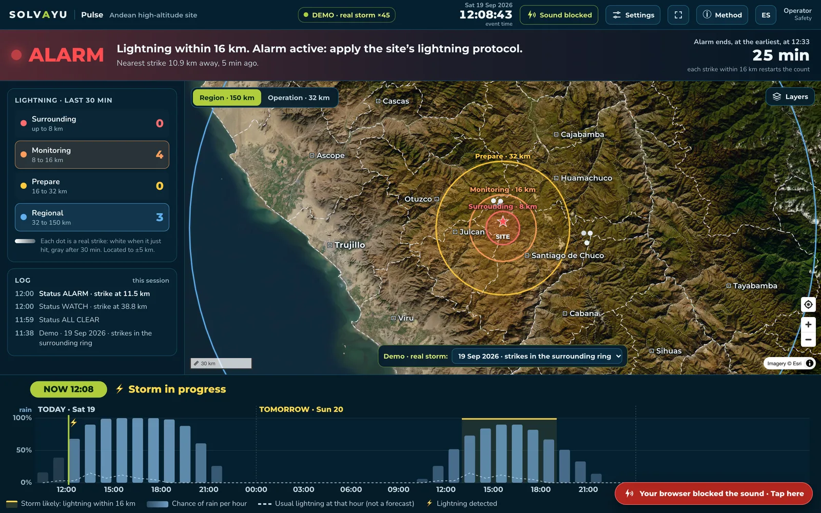
IEC 62793 alarm from observed lightning, minute by minute.
satellite early warning: live trial from 15 Oct

Solvayu Pulse · Weather Intelligence for Critical Operations
Solvayu Pulse tracks lightning from space over your operation and anticipates when it may strike nearby. Minute by minute, with nothing to install. Live across the Americas today; Europe and Africa are next. Fog, extreme rain and frost are on the way.
of storms flagged before the first strike within 8 km, with a 66-minute median lead time.
Satellite early warning · blind replay over 8 months unseen by the model · IEC 62793 methodcorrelation between our satellite lightning counts and an independent ground network (1 = perfect match).
37 sites · 12 months · Spearman correlationin 13 countries measured for a full year, file by file: 1.58 million satellite files, zero read failures.
Lightning census 2025–2026We publish what’s missing, too: a 54% false-alarm ratio against our 50% target. A pre-registered shadow test is underway.
Every module shows its real status. What’s in research, we say so; what’s live, we measure.
IEC 62793 alarm from observed lightning, minute by minute.
satellite early warning: live trial from 15 OctLightning probability calibrated on site history.
Chance of rain every hour, next to the storm forecast.
UV index now and ahead for every district in Peru.
open · uv.solvayu.comHow much the sea off Peru has warmed, every week. In El Niño years, history stops being a guide: so we measure.
open · weeklyNight-time detection from space, tested on a coastal corridor. For roads, ports and airfields.
Hourly forecast for lifting, blasting and work at height.
Basin rainfall and debris-flow thresholds.
For people, crops and livestock.
Detection and drift, seen from space.
Geostationary satellites —lightning every 20 seconds, clouds every 10 minutes—, global models and on-site stations.
Machine-learning models calibrated on each site’s own history. Measured probabilities, not guesses.
Dashboard, sound, WhatsApp, API and MCP, in the language of the standard. Pulse informs; your site decides.
No sensors to calibrate or maintain, and no false alarms from dust, engines, welding or power lines.
A REST API and an MCP server: connect Pulse to dispatch, SCADA or radios, or ask your AI assistant whether a storm is near your site.
curl https://api.solvayu.com/v1/sites/demo/status \
  -H "Authorization: Bearer $SOLVAYU_KEY"

{ "status": "alarm",
  "nearest_strike_km": 10.9,
"alarm_ends_earliest": "12:33" }{ "mcpServers": {
"solvayu": { "url": "https://mcp.solvayu.com" } } }
› Is there lightning within 16 km of my site?
Yes: alarm active, nearest strike 10.9 km away.Illustrative examples. Request early access and we’ll let you know when your key is ready. Request access →
Criteria set before seeing results, standard metrics and open data. Science you can check.
Cutting false alarms without losing lead time where storms form right over the site.
Inferring lightning from cloud imagery alone, for regions and satellites with no optical lightning mapper.
Visibility calibrated with real sensors on haul roads and in ports.
Basin-level thresholds for El Niño years in the Andes.
The demo replays real storms recorded at an Andean site. Turn the sound on: each ring sounds different.